Untitled attachment
https://digipres.club/system/media_attachments/files/113/734/141/332/087/061/original/666ec02bc1624781.png

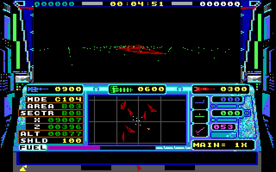
I think the map format might be tile-based rather than wireframes. You see (on the map) how the rocks in the sector to the bottom-left are the same as the ones in the top-right? That'd make sense if it's just a single value selecting what set of 3D geometry to stuff in the square
076萌SNS is a social network, courtesy of 076. It runs on GNU social, version 2.0.2-beta0, available under the GNU Affero General Public License.
![]() All 076萌SNS content and data are available under the Creative Commons Attribution 3.0 license.
All 076萌SNS content and data are available under the Creative Commons Attribution 3.0 license.