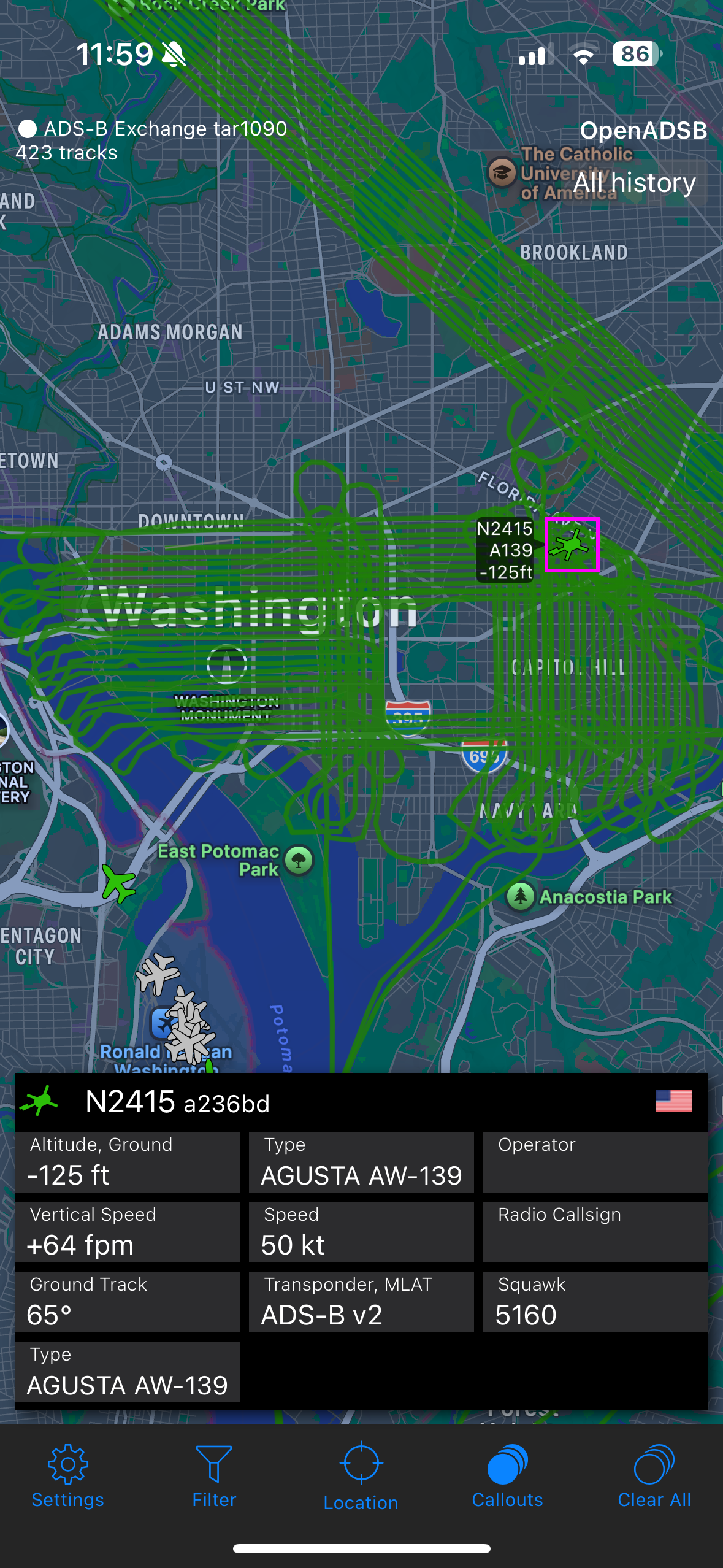
An aviation tracking map of DC, showing a helicopter flying a tight grid pattern.
https://cdn.masto.host/federatesocial/media_attachments/files/113/590/119/115/331/901/original/d2777995e44b0e83.png

DC nerditry: An NNSA survey helicopter (N2415) is doing a low, street by street pattern over DC. This is for a radiological survey to collect baseline data ahead of January’s inauguration.
Good time to bring your isotopes up to the roof.
076萌SNS is a social network, courtesy of 076. It runs on GNU social, version 2.0.2-beta0, available under the GNU Affero General Public License.
![]() All 076萌SNS content and data are available under the Creative Commons Attribution 3.0 license.
All 076萌SNS content and data are available under the Creative Commons Attribution 3.0 license.